"By capturing a precise digital twin of existing conditions, ARCLAB surveys allow for greater design confidence while mitigating potential issues earlier in the project.
This approach minimises disruptions, rework and cost."
combined years of surveying
unique survey projects completed


SAVE TIME.
REDUCE RISKS.
MINIMISE ERRORS.
Traditional survey methods are lower in upfront costs but become more expensive over time. They can lead to costly site re-visits, are prone to human error and have gaps in information that result in rework and delays.
ARCLAB surveys capture 1000x more measurable points compared to 2D surveys, with greater accuracy, efficiency, coverage and precision.
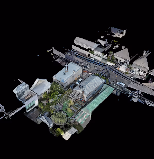
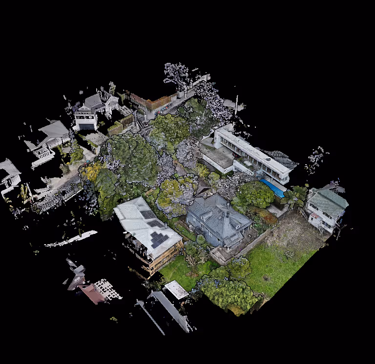
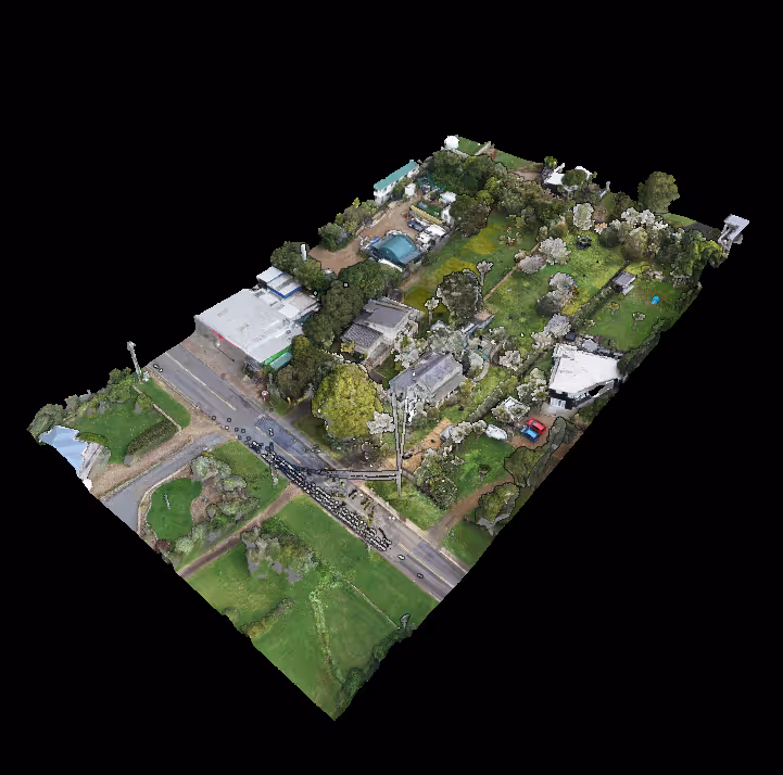
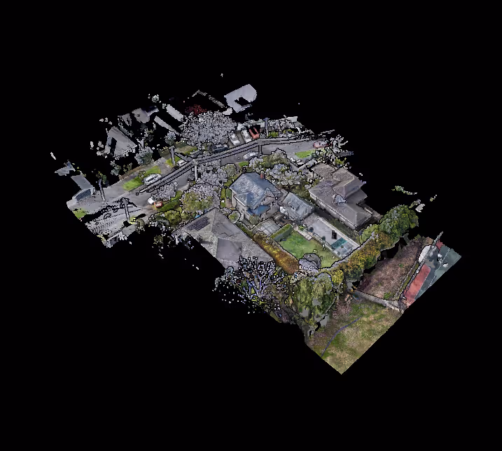
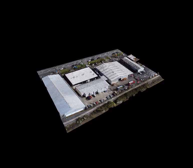
3D Surveying
Using advanced lidar scanners and drones, we digitise your site into millions of survey-grade data points, creating a highly accurate foundation for plans and models.
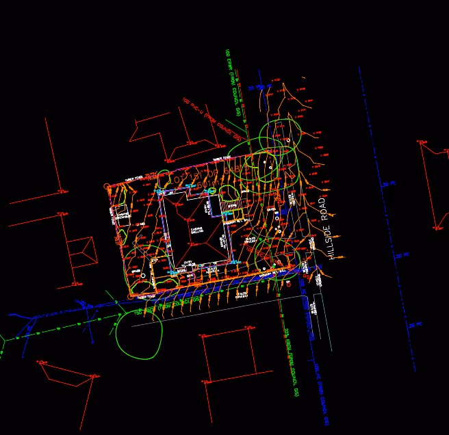
Topographical Surveying
From this rich dataset, we extract ground levels, site features and boundary information, creating a detailed and comprehensive survey plan.
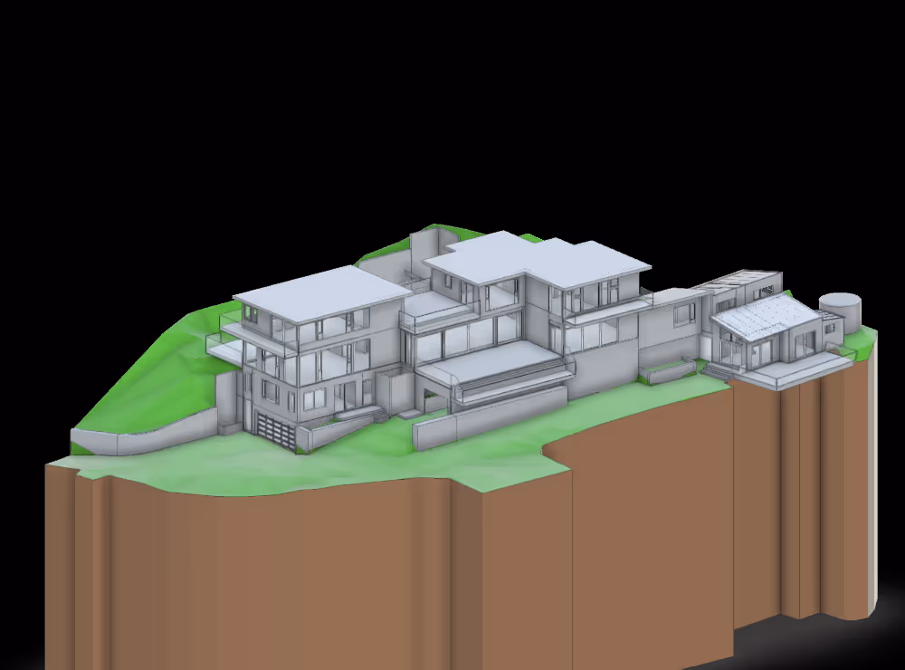
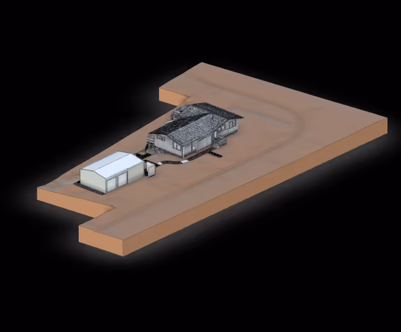
As-Built Modelling
For renovation projects, we engineer highly-accurate architectural models of the existing building, tailored to the requirements of your project.
3D Surveying
Using advanced 3D scanners & drones, we survey the site into millions of precise data points. This dataset forms the foundation for accurate plans and models.
Topographical Surveying
From this rich dataset, we extract ground levels, site features and boundary information, creating a detailed and comprehensive survey plan.
As-Built Modelling
For renovation projects, we engineer highly-accurate architectural models of the existing building, tailored to the requirements of your project.
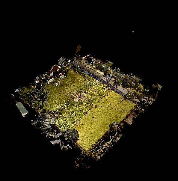
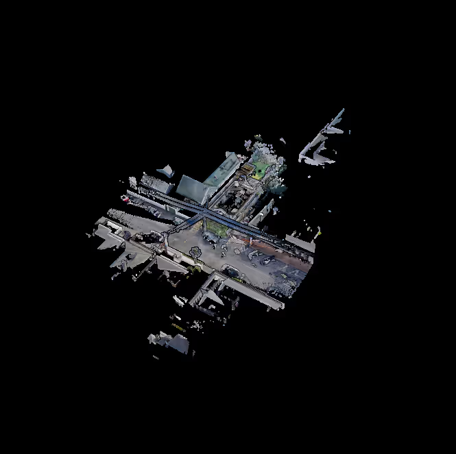
3D SURVEYING
Precise, mm-accurate and high-density spatial data captured using mobile & tripod-based LiDAR scanners. This serves as the starting point for all of our survey projects, including interior scans & exterior facade and topographical surveys.
Outputs:
Point Clouds, Photosphere Walkthrough

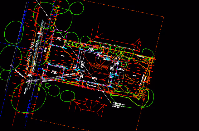
TOPOGRAPHICAL SURVEYING
Survey of all existing exterior site features, including ground levels, elevation changes, contours, building levels, footprints, roof, boundary & easements, and any other relevant key site features.
Output:
Survey Plans
OTHER SERVICES:
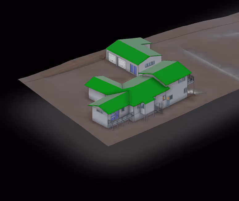
AS-BUILT MODELLING
The creation of detailed 2D drawings or 3D digital models that represent the exact current conditions of a building or structure. These models are used to compare real-world conditions with design plans or for renovations and retrofitting.
Output:
BIM Documentation
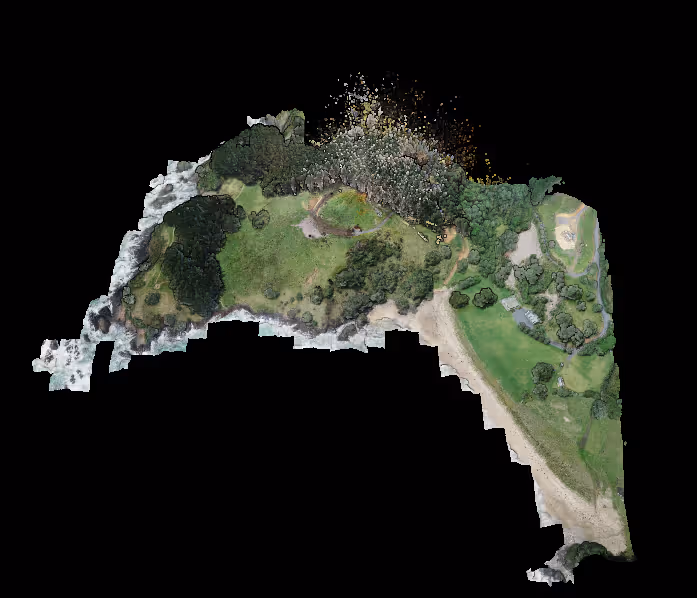
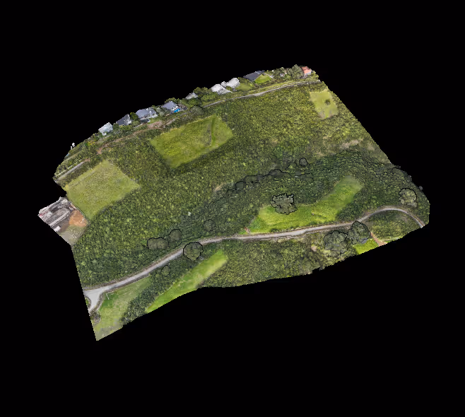
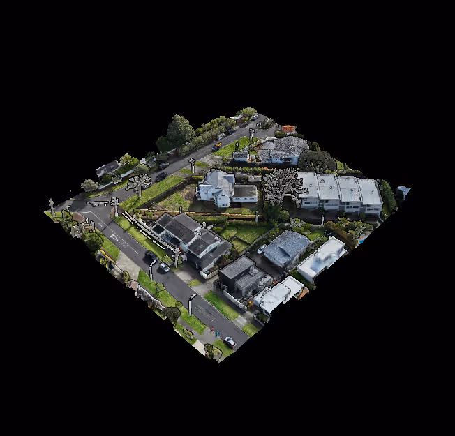
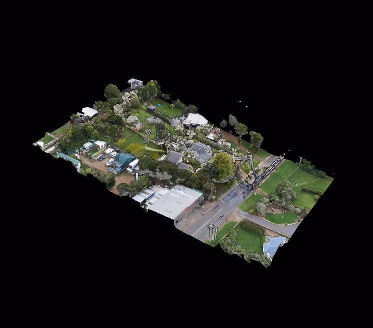
AERIAL MAPPING
Aerial LiDAR and photogrammetry for high-resolution imagery, 3D models, and detailed contextual mapping from above. Ideal for surveying large-scale sites or hard-to-access areas.
Outputs:
Aerial Orthophoto, Point Clouds, Reality Mesh
METROLOGY SCANNING
Ultra-precise measurements of industrial components and structures (+/-0.025mm), metrology services ensure accuracy and quality for manufacturing, engineering, and inspection processes.
Outputs:
Point Clouds, Reality Mesh
LAND SURVEYING
Site setouts, removal of limitations, boundary redefinition surveys, drainage as-builts, scheme plans, subdivisions, unit titles, cross leases and cadastral certifications (including setout and HIRB).
Outputs:
Survey Plans, Specialised Outputs
SPECIALISED SURVEYS & MONITORING
Project-specific surveys, including deformation monitoring, floor flatness reports, environmental assessments, and bespoke measurement services, helping ensure long-term site safety and performance.
Outputs:
Specialised Outputs
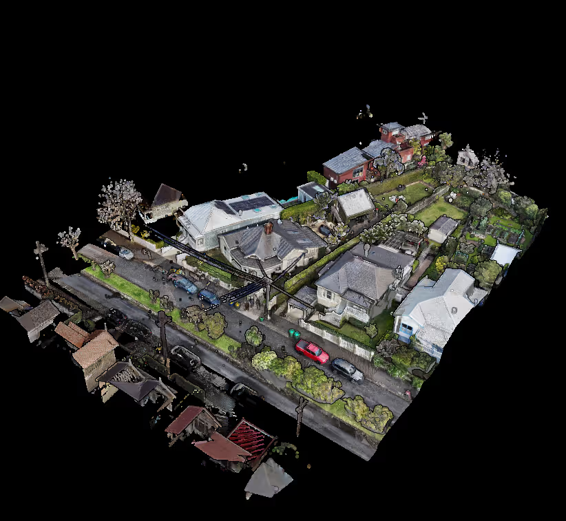
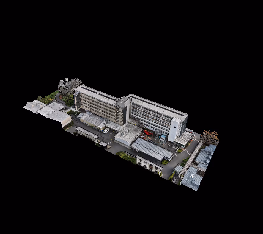
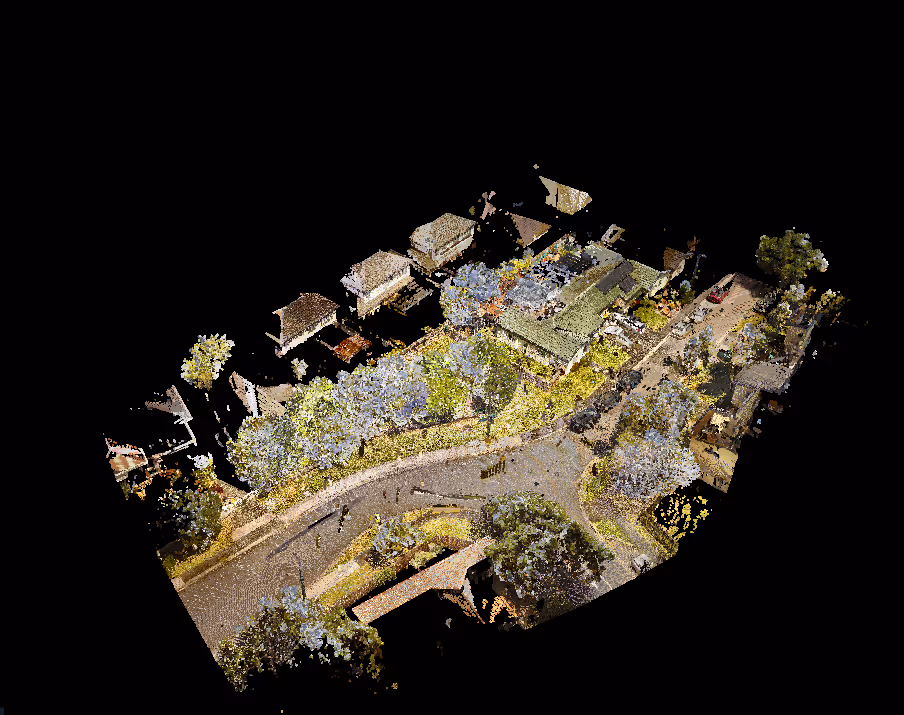
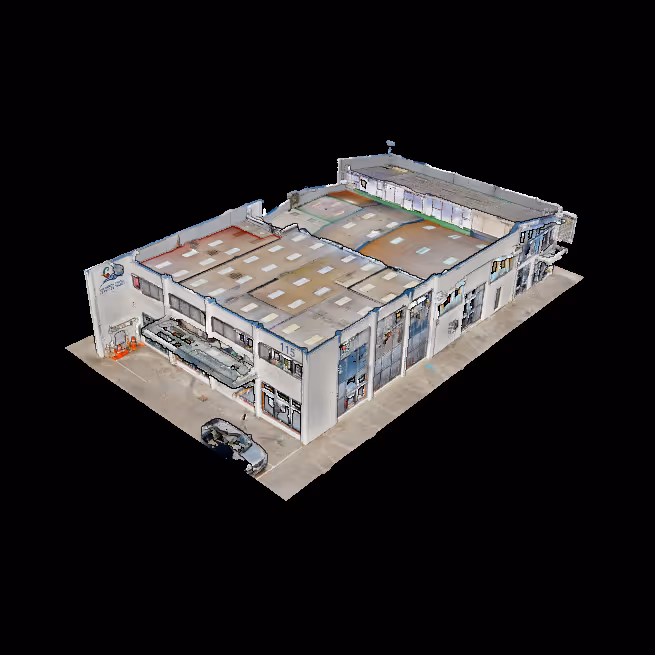
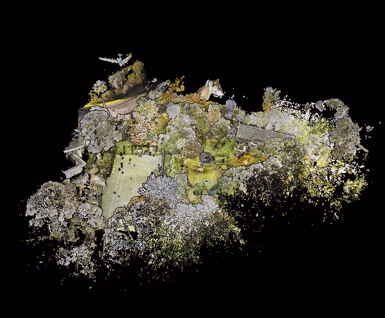
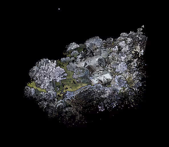
POINT CLOUDS
Millions of data points in digital space, generated by 3D scanning such as LiDAR or photogrammetry. These datasets represent the surface of an object or environment in high levels of detail, and are the starting point for engineering further datasets.
File Outputs:
.rcs .rcp .e57 .las
PHOTOSPHERE WALKTHROUGH
High-resolution panoramic imagery spatially located in a web-based viewer, allowing users to virtually explore a space as though they were physically present.
File Outputs:
web-based link
SURVEY PLANS
Detailed 2D drawing of a site, with layers showing legal information and features of the property. Critical for all construction projects, providing accurate data about the topography and existing conditions, so that all consultants have a clear understanding of land characteristics.
File Outputs:
.dwg .pdf
BIM DOCUMENTATION
3D digital representations of a building specifically for architectural and engineering outputs. Modelled natively within ArchiCAD or Autodesk Revit, and tailored to project requirements.
File Outputs:
ArchiCAD .pln, Revit .rvt, Sketchup .skp
REALITY MESH
Textured 3D models derived from metrology scanning or photogrammetry. Represent real-world objects or environments with a high degree of accuracy and texture, and are useful to create highly detailed visualisations and renders.
File Outputs:
.fbx .obj Rhino .3dm
AERIAL ORTHOPHOTO
A geometrically-corrected image captured from above that has been adjusted to remove distortions caused by perspective. Provides a true-to-scale image of the ground and up-to-date visual information for decision-making.
File Outputs:
.tiff .jpg
SPECIALISED OUTPUTS
Custom data or deliverables tailored to meet specific project requirements. Can include detailed reports, custom visualizations, or unique data formats.
The best survey platform in the industry.
ARCLAB.SPACE is our interactive and measureable online portal to access all your survey datasets in realtime - including as-built models, point clouds and virtual walkthroughs.